Cross country Mountain Bike Trail to Mont Macaron from Châteauneuf-Villevieille
Route Overview
This mountain bike ride over the summit of 806 m Mont Macaron is a perfect half-day leisurely cycle in the Cote d’Azur. Combine the ride with a cultural interlude and visit the stunning ruins of Châteauneuf along the way. In Roman times the village at the site of the current Châteauneuf was named Villa Vetula, hence the current Villevielle.
Later, during the sixth century, invasions forced the villagers to protect their site by building on the hills around the fortified castle of Châteauneuf. In the early nineteenth century, the farmers moved down to the original site to be closer to the land and built the Villa Vetula which was called Chateauneuf-de-Contes until 1992 but is now called Châteauneuf-Villevieille.

The Route
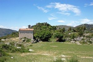
From the Col de Châteauneuf (626 m) on the RD 815, take the narrow Route des Chevaliers de Malte 1 km to the medieval ruins of Châteauneuf and the Chapel St-Joseph (709 m).
Lift your bike over the access gate and freewheel along the ridge until you reach an intersection.
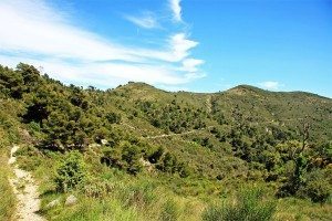
Take the right hand trail up the switchback to open ground before coming back on yourself. The trail dips before the climb to the summit.
With a final push you’ll reach the geographical summit of Mont Macaron (806 m).
Descend Mont Macaron either by retracing your route up, or for a more technical descent, cut across to the St-Joseph valley on one of the marked trails.
Once you reach the ruins, follow the road back to the Col de Chateauneuf.
A note of caution: Take care cycling around the ruins, there are a number of hidden drops.

Route Notes
- Departure point: Col de Châteauneuf
- Altitude at trail start: 626 m
- Length: 7 km
- Climb: 180 m
- Descent: 180 m
- Duration: 1 hour 30 mins
- Difficulty: easy
- Best time to ride: year round
Getting There
From Nice city centre, go up the valley to Tunn du Paillon (RD.2204 then RD.15).
Turn left onto RD.815 then turn right onto Route des Chevaliers de Malte and you will reach Col de Châteauneuf, the starting point of the route.
[mappress mapid=”7″]
