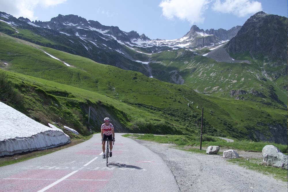
The French Alps’ outstanding climbs
The French Alps is home to some of the most famous and challenging cycle climbs in the Tour de France. But you don’t have to be a pro to enjoy the pain and glory of an epic climb, with a bit of training and the right backup you can tackle any of the rides on this list. And, because you’re in the French Alps, your efforts are rewarded at the end of the day with a hearty raclette, fondue or tartiflette, sloshed down with vin rouge – calories out, calories in!
The French Alps cycle climbs are the stuff that dreams are made of. Think blue skies, fresh air and snow-capped peaks. Some are Tour classics that let you test yourself against cycling’s best and some are challenging yet doable ascents through spectacular scenery. All these climbs will set your legs on fire and all are hugely rewarding when you make it to the top.
French Alps Cycling Tours and Holidays
[sabai-directory category=cycle-tours-holidays address=Bourg-Saint-Maurice distance=100 hide_nav=1 perpage=3]
Top French Alps Cycle Climbs by Region
[su_box]

Savoie Road Cycle Climbs
Savoie is covered in mountains including iconic peaks like Mont Pourri, the Dent Parrachée and La Grande Motte. It’s home to the largest number of ski resorts in France, including those of the 3 Valleys and the Tarentaise. Cycling highlights include the Col de l’Iseran, the Col du Galibier and the Col de la Madeleine. Nearest airport: Grenoble/Geneva.
[/su_box]
Col de l’Iseran from Bourg-Saint-Maurice
A long 48 km climb out of Bourg-Saint-Maurice through Tignes and Val d’Isère up to the highest paved pass in the Alps. Despite its length the gradient is manageable and it’s without doubt one of the most beautiful ascents in the Alps. After Val d’Isère, the gradient ramps up, the road narrows, but there’s a lot less traffic. At the top, enjoy panoramic views across the Italian border and refuel at the Restaurant d’Altitude.
Region: Vanoise. Length: 48 km. Height: 2764 m.
Altitude gain: 1955 m. Avg gradient: 4.1%. Max gradient: 6.9%.
Col du Mont Cenis from Lanslebourg-Mont-Cenis
This is a short but steep and rewarding climb right on the Italian border. From Lanslebourg in France the Col is open between 15 May and 31 October, whereas from Susa on the Italian side it is open all year. The scenery is spectacular, the tarmac is good, and the fluorescent blue of Lac du Mont Cenis has to be seen to be believed. Allow an hour and a half for the climb and twenty minutes for the descent. You can hire decent road bikes set up for climbing in Lanslevillard.
Region: Massif du Mont Cenis. Length: 9.8 km. Height: 2081 m.
Altitude gain: 682 m. Avg gradient: 7.0%. Max gradient: 10.6%.
Col du Télégraphe from Saint-Michel-de-Maurienne
A great warm up for the Galibier, the Col du Télégraphe is the bridge between the Maurienne Valley and Valloire. The Maurienne side is the most interesting with 14 hairpin bends winding you up through forest to 1566 m. The gradient is steep but steady so it’s easy to find your rhythm. The road is good and wide and it’s just as well given the volume of traffic. Set off early in the morning if you want a quiet road. If you’re feeling fit, keep going to Valloire and then take on the Col du Galibier.
Region: Massif des Arves. Length: 11.8 km. Height: 1566 m.
Altitude gain: 856 m. Avg gradient: 7.3%. Max gradient: 9.7%.
Col du Galibier from Valloire
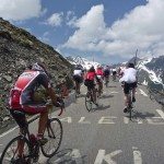
The Galibier is a firm favourite amongst fans of Alpine cycling and regularly included in the Tour du France. It’s a beast of a climb, you leave Valloire straight into an 8% gradient before it flattens out for 2 km as you approach Bonnenuit. Make the most of it, as you round the bend from Plan Lachat the switchbacks seem to get steeper and steeper. The last 2km are brutal, but the views and the feeling of satisfaction as you reach the top of this narrow col make the punishment worthwhile. Grab a bite at the summit and enjoy the jaw-dropping backdrop of the Ecrins range on one side and the Mont Blanc on the other.
Region: Massif des Arves. Length: 18.1 km. Height: 2642 m.
Altitude gain: 1245 m. Avg gradient: 6.9%. Max gradient: 10.5%.

Col de la Croix de Fer from Saint-Etienne-de-Cuines
This is a great climb. It’s considered hard both because of its length and the gradient, but the payoff is the classic Alpine scenery. The route follows the beautiful Glandon river most of the way. For the first 10 km or so you’re climbing at a steady but comfortable rate. Then after Saint Colomban, it’s a thigh burner, the gradient picks up but you’ve got to keep it steady and hold something back for the top.
Region: Maurienne Valley. Length: 22.78 km. Height: 2067 m.
Altitude gain: 1582 m. Avg gradient: 6.9%. Max gradient: 13.0%.
Col du Glandon from La Chambre
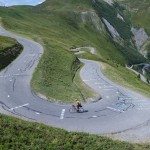
Just below the Col de la Croix de Fer, the Col du Glandon is another Tour de France climb. You can tackle the ascent from La Chambre or for an easier climb, approach it from Bourg d’Oisans. From La Chambre it’s a tough ride. The last 2 km are insanely steep, so stock up on energy bars and pace yourself through the first 15 km. The first half of the climb is a straightforward steady climb through shady forest until you reach Saint-Colomban-des-Villards. Then you hit the switchbacks which reach 11% in places, but with the majestic mountain scenery and the Glandon river for company, there’s plenty to spur you on.
Region: Maurienne Valley. Length: 21.3 km. Height: 1924 m.
Altitude gain: 1472 m. Avg gradient: 6.9%. Max gradient: 11.0%.
Col de la Madeleine from Feissons-sur-Isère
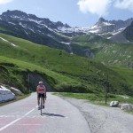
Having featured 25 times in the Tour de France since 1969, the Col de la Madeleine is one of the iconic climbs of the French Alps. It’s also one of the toughest, but the scenery is breathtaking with views over the Mont Blanc and the Lauzière range. It’s steep out of the gate, but overall the first 16 km are relatively straightforward. After Celliers there’s 2 km of 10% thigh-burning tarmac that will send your heart rate racing. The climb then levels off until the last lung-busting 5 km. Grab a drink and a well-earned rest at La Banquise 2000 before embarking on the often freezing cold descent.
Region: Vanoise. Length: 24.5 km. Height: 1993 m.
Altitude gain: 1543 m. Avg gradient: 6.3%. Max gradient: 12.0%.
[su_box]

Haute-Savoie Road Cycle Climbs
Haute-Savoie borders Lac Léman and Switzerland to the north and Italy to the west, and is home to the majestic Mont Blanc, the highest mountain in the Alps. It’s also here that you’ll find some of the best known ski resorts in the French Alps, including Chamonix, La Clusaz and Morzine. Short transfer times from Geneva airport make Haute-Savoie a favourite destination for UK cyclists arriving by plane.
[/su_box]
Col de Joux Plane from Morzine
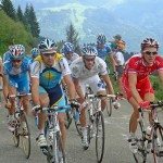
Taking on the Joux Plane from Morzine is easier than from Samoëns, but you’ll struggle to believe that as you set off from Morzine straight into 3 km of brutal climbing. After that, the road flattens out through the forest giving you an opportunity to spin off the lactic acid. The climb then snakes and undulates with a couple of flat sections, before the gradient ramps up for another hard section as you approach the 1658 m Col du Ranfolly. Once past the col, you’re home free. There’s a short, sharp climb followed by a long drag to the top of Joux Plane.
Region: Massif du Mont Cenis. Length: 10.9 km. Height: 1691 m.
Altitude gain: 711 m. Avg gradient: 6.5%. Max gradient: 11.1%.
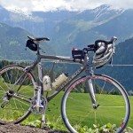
Plateau des Saix from Samoëns
The Plateau des Saix is relentless. With an average gradient of 9.24% it cuts an impressive profile throughout its 10 km. As you round the bend by Hôtel le Moulin du Bathieu you’ll likely drop in to your easiest gear and there you’ll stay, grinding it out to the top. Thankfully it is only 10 km and as with other cols in this area, the views are magic. Another bonus is that the road is relatively quiet and the tarmac is nice and smooth.
Region: Giffre & Chablais. Length: 10.0 km. Height: 1626 m.
Altitude gain: 924 m. Avg gradient: 9.2%. Max gradient: 11.4%.
[su_box]

Isère Road Cycle Climbs
Extending from just south of Lyon to the 4000 m peaks of the Ecrins National Park, Isère is home to some formidable cycling terrain, including the legendary Alpe d’Huez climb and the beautiful Chartreuse mountains just north of the department capital, Grenoble.
[/su_box]
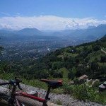
Col de Porte from Grenoble
This climb is tough out of the gate with no time to warm up the legs before you’re into 10% gradient. The climb slackens off after kilometre 9 and the latter half is steady and perfectly manageable. The Chartreuse mountains provide a stunning backdrop and the tarmac’s in good condition, although in the summer the road can get busy with tourist traffic. If you’re feeling fit you can add another 5 km to the ride and continue on to Châlet de Charmant Som.
Region: Chartreuse. Length: 17.7 km. Height: 1326 m.
Altitude gain: 1116 m. Avg gradient: 6.3%. Max gradient: 10.1%.
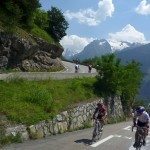
Alpe d’Huez from Bourg d’Oisans
In the world of cycling, Alpe d’Huez needs no introduction. As a stand alone climb, the 13 clicks through 21 bends isn’t the toughest ride in the Alps. However, in the Tour de France, Alpe d’huez is a grand finale to a usually brutal Alpine stage, often including Madeleine, La Croix de Fer and Glandon. Starting from Bourg d’Oisans you’re straight into 10+ percent gradient for the first 3 km. You then settle into a steady 8% grind through Huez and up to Alpe d’Huez. Lots of traffic and some say urban anticlimax at the arrival, but you’ll feel a huge sense of achievement from having climbed this legendary col.
Region: Arves et Grandes Rousses. Length: 13.9 km. Height: 1815 m.
Altitude gain: 1119 m. Avg gradient: 8.1%. Max gradient: 13.0%.

